
This page looks back at weather patterns and provides a summary, using Met Office data, of notable weather events, mean rainfall and mean temperature.
May began with a shallow area of low pressure which brought cool showery weather, but high pressure built from the north-west between the 2nd and 4th, turning the weather more settled.
There was plenty of warm sunny weather between the 5th and 9th, but showers broke out in places fafter this. Northerly winds brought a cold snap from the 10th to 15th, with wintry showers for the north and east of Scotland, and some overnight frost. There was a more changeable spells from the 16th to 23rd, but with plenty of warm sunshine at times in the south. High pressure dominated during the last few days of the month bringing generally dry, sunny and warm weather.
The UK monthly extremes were:
Maximum temperature of 28.3 °C at Cromdale (Morayshire) on the 29th.
Minimum temperature of -6.6 °C at Kinbrace (Sutherland) on the 3rd.
In the 24 hours ending at 0900 GMT on the 23rd, 97.2 mm of rain fell at Achnagart (Ross & Cromarty).
April 2020
Much of April was fine and settled, though with some shorter spells that brought rain. High pressure was located in the vicinity of the UK for much of the time, often to the north, and so easterly winds were a regular feature.
Less settled spells came at the start of the month, from the 1st to 6th, the 11th to 13th, and most notably a cyclonic spell from the 27th onwards.
Plenty of sunshine generally allowed daytime temperatures to rise well above normal , whereas minimum temperatures were barely above normal and in fact northern and eastern Scotland had several late frosts. Rainfall was well below normal quite widely, with only central southern counties of England having near-average rain totals.
The UK monthly extremes were:
Maximum temperature of 26.0 °C at Treknow (Cornwall) on the 10th.
Minimum temperature of -6.9 °C at Aboyne (Aberdeenshire) on the 19th.
In the 24 hours ending at 0900 GMT on the 18th, 38.4 mm of rain fell at Portsea (Hampshire).
March 2020
March began with a cool showery westerly type, bringing sunshine and showers and some longer spells of rain, with sleet and snow on high ground.
March was generally milder and more unsettled mid-month with regular belts of rain crossing the country, combined with brighter showery weather. High pressure then slowly built across the British Isles, and a spell of dry sunny weather followed for most of the country, with much of England, Wales and southern Scotland having plenty of sunshine from the 22nd to 27th, with warm days and cold nights. During this spell, slowmoving fronts often brought more cloud and some rain to north-western Britain. A northerly outbreak brought wintry showers to eastern areas on the 28th, followed by mostly dry but relatively cloudy weather.
The UK monthly extremes were:
Maximum temperature of 19.4 °C at Rhyl (Clwyd) on the 24th.
Minimum temperature of -7.6 °C at Aboyne (Aberdeenshire) on the 16th.
In the 24 hours ending at 0900 GMT on the 8th, 107.2 mm of rain fell at Skye Alltdearg House.
February 2020
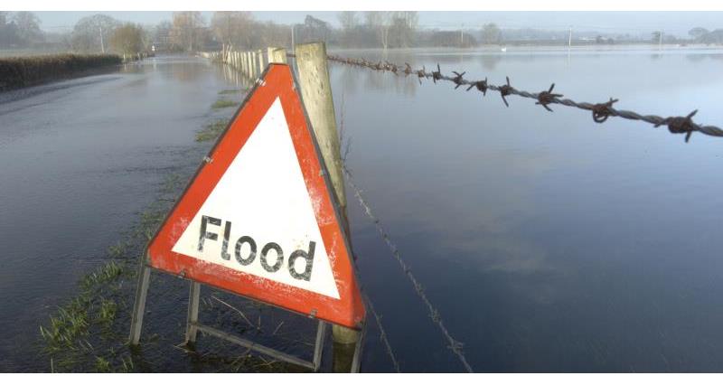
February began with four days of changeable westerlies, then high pressure briefly moved across the country between the 5th and 7th bringing settled weather. The rest of the month was windy and exceptionally wet, with rain frequently moving in from the west and south-west and giving large total rainfall.
Storm Ciara on the 9th and Storm Dennis on the 15th brought exceptional rainfall to much of the country. In between the rain belts, there were brighter spells and blustery showers, and the showers were wintry at times, especially in the north.
Both mean maximum and minimum temperatures were less than 0.5 °C above average over much of Scotland and Northern Ireland, but were 2 to 3 °C above average in southern England and parts of the Midlands, East Anglia and south Wales.
It was the wettest February in a series from 1862, with 237% of average, and some locations had over 400% of the long-term average, but rainfall was near normal in parts of north-east Scotland. Sunshine was 104% of average, and it was a dull month in most western areas but sunnier than normal in the east, especially around Aberdeenshire, and sunshine was also slightly above average in Northern Ireland.
The UK monthly extremes were:
Maximum temperature of 16.0 °C at East Malling (Kent) on the 16th.
Minimum temperature of -10.2 °C at Braemar (Aberdeenshire) on the 13th.
In the 24 hours ending at 0900 GMT on the 20th, 180.4 mm of rain fell at Honister Pass (Cumbria)
January 2020
January began with high pressure lover southern parts of the UK, bringing settled weather and plenty of cloud. Midmonth the weather was mild, unsettled and also very windy at times. High pressure brought settled weather from the 18th to 25th, with plenty of sunshine initially. On the 22nd most places were overcast. Wet and windy weather returned from the 26th, and there was snow in some high areas on the 27th and 28th. Mild air returned at the end of the month.
The provisional UK mean temperature was 5.6 °C, which is 2.0 °C above the 1981-2010 long-term average, making it the 6th warmest January in a series from 1884. Mean maximum temperatures were generally around 2.0 °C above average and mean minimum temperatures were mostly 2.0 to 2.5 °C above average.
Frosts were generally fewer than average.
Rainfall was 100% of average, and it was a wet month in western Scotland but drier than average in eastern Scotland, north-east England and Northern Ireland.
Sunshine was 94% of average, and it was a dull month in north-west England, but sunnier than average in north-east England.
The UK monthly extremes were: A maximum temperature of 15.5 °C was recorded at Achfary (Sutherland) on the 7th. A minimum temperature of -7.9 °C was recorded at Braemar (Aberdeenshire) on the 10th.
December 2019
December began with a spell of cold, dry, frosty weather with high pressure and plenty of sunshine, but it quickly turned mild and unsettled with westerly winds, and this regime persisted until Christmas. Temperatures fell close to the seasonal norm around midmonth, but with snow mainly confined to high ground. The last week of the month was generally dry and mild and often cloudy.
The mean temperature for December was provisionally 1.3 °C above the 1981-2010 long-term average. It was a dry December in Northumberland and Tyne and Wear but wetter than average in the south, while sunshine was mostly above average in central and eastern counties but near or below normal in the west.
England had 118% of average rainfall and 123% of average sunshine.

November 2019
November began with mild and wet weather, continuing to be unsettled until the 14th. It turned colder with sleet and snow falling quite widely on high ground and locally to low levels on the 8th/9th and 13th/14th. The 15th to 20th was quieter in most areas with temperatures remaining below average, followed by a milder, wet spell from the 21st to 27th. November finished with a northerly outbreak which brought colder brighter weather. The jet stream was frequently further south than usual which meant that north-west Scotland tended to be relatively dry and sunny.
Provisional UK mean temperature: 5.3 °C (0.9 °C below the 1981-2010 long-term average)
Mean maximum temperature: between 1.0 and 1.5 °C below average, but up to 2 °C below in parts of Scotland.
Mean minimum temperatures: between 1 and 2 °C below average in western Scotland, but generally much closer to normal elsewhere, and up to 0.5 °C above average in some eastern coastal parts of England.
Rainfall: 97% of average, and it was exceptionally wet in parts of the Midlands, Lincolnshire, north-east England, and eastern fringes of Scotland, with more than twice the normal rainfall in places.
The UK monthly extremes
Maximum temperature: 16.9 °C at North Wyke (Devon) on the 1st.
Minimum temperature: -9.9 °C at Braemar (Aberdeenshire) on the 19th.
In the 24 hours ending at 0900 GMT on the 8th, 63.8 mm of rain fell at Sheffield (South Yorkshire). A wind gust of 95 knots (109 mph) was recorded at the Needles (Isle of Wight) on the 2nd. A snow depth of 6 cm was recorded at Cromdale (Morayshire) on the 8th a warm showery day in the south, and while colder air quickly spread from the north followed by a transient ridge of high pressure, low pressure and associated fronts returned by the 4th.
Until the 20th the weather was unsettled with frequent low pressure systems and rain belts crossing the country, and the jet stream was further south than normal, resulting in frontal systems often especially affecting the south and east of England. There was a quieter period from the 21st to 23rd, and then after a very wet spell on the 24th to 26th. The weather turned cold, dry and sunny for most of the country from the 27th to 30th, with the south-west remaining very wet at times.
Click here or here to read the full update from the Met Office.

October 2019
October began with a warm showery day in the south, and while colder air quickly spread from the north followed by a transient ridge of high pressure, low pressure and associated fronts returned by the 4th.
Until the 20th the weather was unsettled with frequent low pressure systems and rain belts crossing the country, and the jet stream was further south than normal, resulting in frontal systems often especially affecting the south and east of England.
There was a quieter interlude from the 21st to 23rd, and then after a very wet spell on the 24th to 26th. The weather turned cold, dry and sunny for most of the country from the 27th to 30th, although the far south-west remained very wet at times.

The provisional UK mean temperature was 9.0 °C, which is 0.5 °C below the 1981-2010 long-term average. Both mean maximum and mean minimum temperatures were within 0.5 °C of the long-term average in the south, but were between 0.5 °C and 1.0 °C below over much of Scotland, Northern Ireland and northern England.
Rainfall was 109% of average, and it was a wet month over most of England and Wales with some parts of eastern England, notably in Yorkshire, and also the far south-west, having more than twice the normal rainfall, but in Scotland, Northern Ireland and Cumbria it was generally drier than average.
Sunshine was 95% of average, and sunshine was below normal over most of England and Wales but above normal in most parts of Scotland, Northern Ireland, Cumbria and north Lancashire.
The UK monthly extremes for October were:
A maximum temperature of 21.3 °C was recorded at Trawsgoed (Dyfed) on the 1st. A minimum temperature of -6.2 °C was recorded at Altnaharra (Sutherland) on the 31st. In the 24 hours ending at 0900 GMT on the 26th, 101.0 mm of rain fell at Lebanus (Powys). A wind gust of 66 knots (76 mph) was recorded at the Needles (Isle of Wight) on the 18th.
Click here to read the full update from the Met Office
Source: Met Office
February 2020